London Thames Gateway (2004)
Design research project for the Greater London Authority (GLA) on Barking & Daggenham and the Lower Lee Valley exploring the potential of and for food-productive urban landscapes (CPUL) within London's future expansion zone.

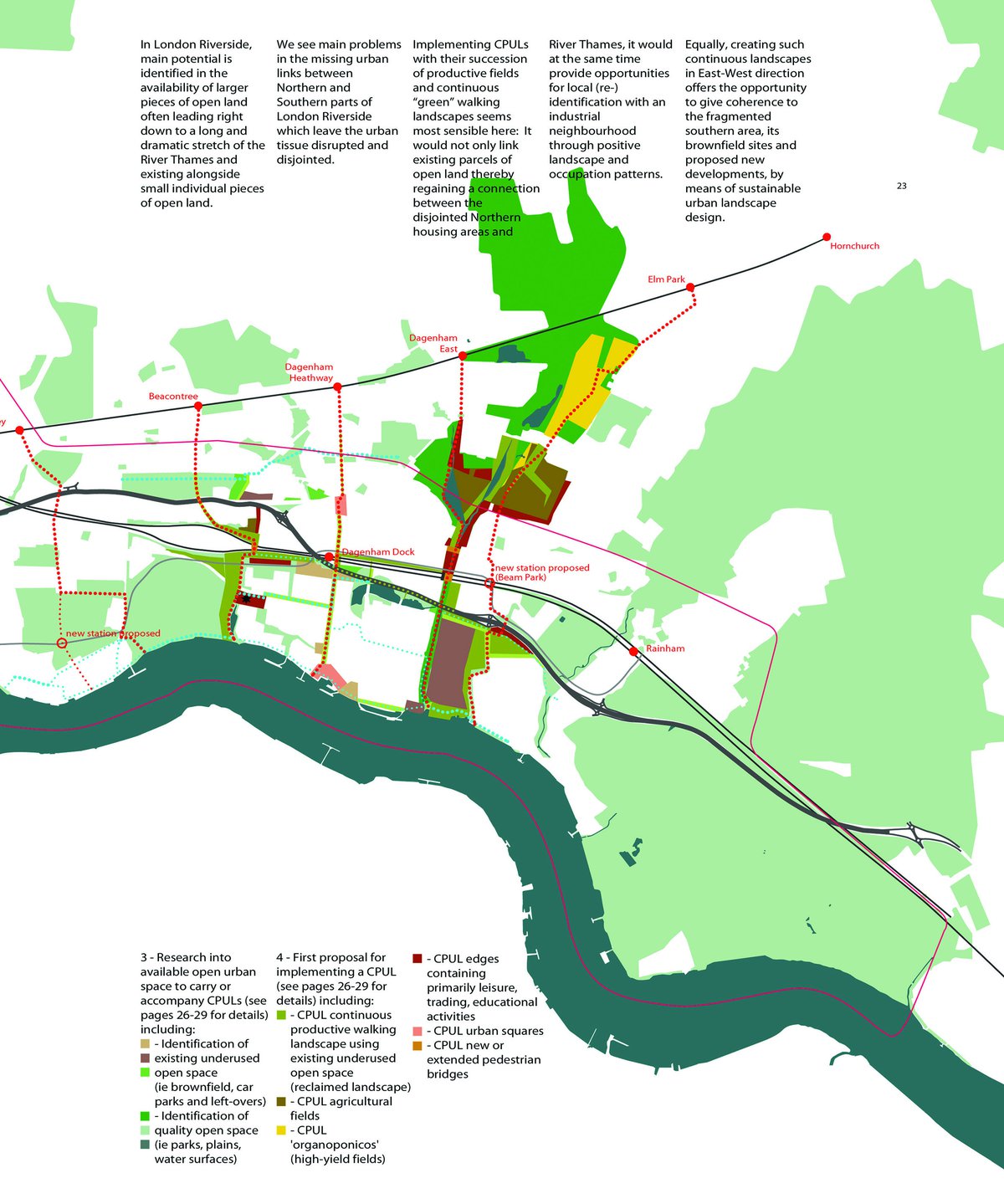
The characteristics of potential food-growing sites are established through fine-grained mappings which we conceptualise as "Inventories of Urban Capacity".